AI Visual Query System
AI Visual Query System
A first-of-its-kind Natural Language Visual Query Interface
that revolutionizes how users interact with geospatial intelligence.
Users simply speak or type questions, and the globe responds with instant
spatial visualization, analytics, graphs, or simulations—eliminating the
need for complex GIS expertise or manual data manipulation.
Examples of Queries
"Highlight deforestation in Amazon for last 10 years"
"Show tiger corridor movement during winter months"
"Predict water scarcity zones for 2026"
"Compare PM2.5 levels of Delhi vs Shanghai"
✔
No manual searching. No complex GIS tools. Just ask — the AI visualizes.
This democratizes access to sophisticated geospatial intelligence,
enabling faster decision-making across all organizational levels.
Global Forests & Wildlife Overview
Understanding Ecosystems & Conservation Needs
80%
Terrestrial Life
Forests are home to 80% of terrestrial biodiversity, providing
critical habitat for millions of species.
30%
Oxygen Production
Forest ecosystems generate roughly 30% of Earth's oxygen while
absorbing massive amounts of CO2.
1.6B
Human Dependence
Over 1.6 billion people depend on forests for their livelihoods,
food security, and cultural identity.
Forests regulate climate patterns, rainfall distribution, and carbon
balance at both regional and global scales. Wildlife depends on connected
habitats to migrate, breed, and survive across generations. Monitoring
forests helps identify ecological health indicators, species movement
patterns, and climate impact trajectories.
Our Goal
Protect forests and wildlife using AI-based tracking, visual analytics,
and sustainability planning to ensure ecosystem resilience for future
generations.
Forest Cover & Deforestation Tracking
AI for Forest Monitoring & Change Detection
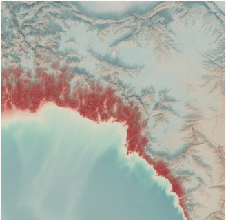
Advanced satellite imagery analysis enables comprehensive monitoring
of forest ecosystems at unprecedented scale and precision. Our AI-powered
change detection algorithms process terabytes of multispectral data to
identify subtle shifts in forest coverage.
Key Capabilities
- Compare past vs present forest cover using high-resolution satellite imagery with temporal analysis spanning decades.
- Generate deforestation timelines to qualify the rate of forest shrinkage or recovery across different regions.
- Detect illegal logging, fires, and land conversion, or mining activities at early stages before significant damage occurs.
- Predict future forest loss trajectories and recommend evidence-based restoration targets using AI forecasting models.
Outcome: Informed decisions for policy formulation, conservation
prioritization, and climate protection strategies backed by quantitative evidence and predictive intelligence.
Wildlife Corridors & Biodiversity Intelligence
Tracking Species, Corridors & Biodiversity Health
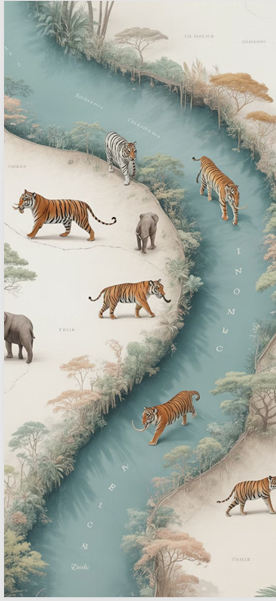
-
Corridor Identification
Identify and map wildlife corridors—critical routes used by tigers, elephants, and other species for migration, genetic diversity, and survival.
-
Population Monitoring
Monitor tiger population trends, migration paths, habitat disturbances, and territorial patterns using camera traps and satellite data fusion.
Impact: Strengthens wildlife safety, ensures balanced ecosystem survival, and creates data-driven conservation strategies
that protect endangered species while supporting human development needs.