AI Visual Query System
Live Forest 360° Monitoring
Real-Time Vision of Forest Ecosystems
Forests equipped with 360° live cameras and comprehensive sensor networks
provide continuous visibility of forest activity around the clock. This technology
enables forest guards, researchers, and conservation teams to observe remote zones
without physical presence, dramatically reducing response times and increasing
monitoring coverage.
The system captures habitat behavior, seasonal changes, visitor patterns, and
potential poacher movement in real-time, creating a digital twin of the forest
ecosystem that can be accessed from anywhere.
Core Benefits
- 24/7 monitoring with day and night vision capabilities
- Remote accessibility for distributed teams and rapid response coordination
- Historical playback for incident investigation and pattern analysis
- Integration with AI threat detection and automated alert systems
Purpose:
Create a transparent, constantly monitored forest environment that deters illegal
activity while providing invaluable research data for conservation science.
Drones + Live Feed Surveillance
Aerial Intelligence for Deep Forest Access
Comprehensive Coverage
Drone flyovers cover dense and unreachable forest areas that are
inaccessible to ground patrols, providing complete situational
awareness across vast territories.
Live HD Intelligence
Real-time high-definition video feeds enable monitoring of wildlife
spread, illegal logging operations, and animal movement patterns
as events unfold.
AI Anomaly Detection
Advanced AI algorithms detect anomalies including smoke,
unauthorized vehicles, illegal entry, and suspicious activity
patterns instantly.
Thermal Night Vision
Thermal drones track nighttime wildlife activity and poaching risks,
operating effectively in complete darkness when most illegal
activity occurs.
Benefit: Enables fast response times, broader territorial coverage, and safer forest patrolling operations while reducing risk to human personnel and increasing enforcement effectiveness.
How AI Makes It Reliable
Smart Monitoring Powered by Artificial Intelligence
AI transforms raw video feeds and sensor data into actionable intelligence
that enables proactive forest management and wildlife protection. Machine learning
models trained on millions of images can identify threats and opportunities that
human observers might miss.
Wildlife Detection
Identifies and classifies animals (tiger, elephant, deer, leopard, etc.)
in real-time with species-specific behavioral analysis
Threat Alerts
Flags poachers, weapons, suspicious activity patterns, and unauthorized
entry with automated alert escalation
Fire & Disaster Alerts
Detects smoke, fire spread patterns, and illegal logging instantly with
predictive modeling for containment
Population Tracking
Counts animals automatically through camera feeds, tracks individuals,
and monitors population health trends
Night Monitoring
Thermal imaging combined with low-light AI vision ensures complete
visibility after dark when threats increase
Outcome: A self-operating intelligent forest watch system
that reduces manual monitoring burden by 70%, enables early action on threats,
protects wildlife more effectively, and provides comprehensive data for
conservation planning.
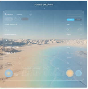
Climate & Temperature Monitoring
AI-Powered Climate Intelligence
→ Real-Time Climate Visualization
Real-time visualization of global heat patterns, ocean warming trajectories,
and seasonal climate shifts with precision down to regional microclimates.
→ Historical Comparison
Compare historical climate data spanning decades against present trends
to detect rising temperature zones and identify acceleration patterns
in climate change.
→ Anomaly Detection
AI-based anomaly detection provides early alerts for heatwaves, drought
risk zones, glacial decline, and extreme weather events before they reach
crisis levels.
How AI Helps
-
AI models analyze decades of climate data from multiple sources—satellites,
weather stations, ocean buoys, and atmospheric sensors—to identify patterns
invisible to traditional analysis methods.
-
The system predicts heat patterns months in advance, identifies climate
risk zones with precision, and assists policymakers with evidence-based
climate-response planning, carbon reduction strategies, and adaptation
measures.
Pollution Tracking & Air Quality Intelligence
Comprehensive air quality monitoring combines satellite observations with ground-level sensors to create the most accurate pollution intelligence available.
The system tracks multiple pollutants simultaneously across urban, rural, and remote environments.
1
Live Air Quality Tracking
Real-time monitoring of PM2.5, PM10, CO2, methane, NOx, SO2, and industrial pollutants with hourly updates and trend analysis.
2
Pollution Movement Mapping
Track pollution plume movement across cities, forests, and oceans, revealing how air quality issues spread across borders and ecosystems.
3
Multi-Source Data Fusion
Satellite observations combined with ground sensor networks and industrial monitoring systems create highly accurate pollution hotspot identification.
AI Enhancement: AI forecasts pollution flow direction based on weather patterns,
identifies pollution sources through reverse trajectory modeling, and predicts Air Quality Index (AQI) hours or days in advance.
This enables proactive controls, policy interventions, and public health advisories before dangerous conditions develop.
Predictive Climate & Environment Insights
Future Scenario Modeling & Decision Support
Advanced predictive modeling enables organizations and governments to prepare for future environmental conditions with confidence.
The system runs sophisticated simulations that account for hundreds of variables and feedback loops.
Predictive Capabilities
- Model future climate scenarios with multiple emission pathways and carbon impact simulations
- Cross-layer correlation analysis connecting temperature, pollution, population density, and land use patterns
- AI detects invisible patterns like pollution spikes after festivals, traffic congestion impacts, or wildfire smoke drift patterns
Disaster Preparedness
Enhanced disaster preparedness through early warning systems and vulnerability mapping
Urban Planning
Climate-aware urban planning that accounts for future heat stress and flood risk
Energy Strategy
Green energy strategy decisions optimized for regional climate conditions
Carbon Planning
Carbon neutrality planning with country-specific roadmaps and sectoral targets
Outcome with AI: Better disaster preparedness, climate-resilient infrastructure development,
informed energy policy decisions, and actionable pathways toward carbon neutrality backed by quantitative modeling.
Water Resources & Basin Intelligence
Comprehensive Watershed Management
Water security is fundamental to economic stability, food production, and public health.
Our platform provides unprecedented visibility into water resources across entire watersheds and river basins.
Basin Monitoring
Live monitoring of river basins, watersheds, and reservoir levels with real-time depth measurements and storage capacity tracking across interconnected water systems.
Flow Visualization
Comprehensive visualization of water flow patterns, rainfall distribution, and seasonal variations that affect availability throughout the year.
Historical Comparison
Compare current water availability against historical baselines spanning decades to identify long-term trends and emerging stress patterns.
AI Value Add: AI analyzes inflow-outflow balance across entire watersheds, detects abnormal drops indicating potential crisis conditions,
and prevents water shortages through early alerts on reservoir stress and regional scarcity that enable timely intervention.
Flood Risk Detection & Early Warning
Predictive Flood Intelligence for Disaster Prevention
Flooding causes billions in damage annually and claims thousands of lives. Our AI-powered flood prediction system provides critical advance warning that saves lives and reduces economic losses through proactive preparation.
System Capabilities
-
Real-time flood zone visualization using
integrated satellite imagery, hydrological models, and weather feeds
-
AI identifies high-risk flood regions based on water level rise, soil saturation levels, and rainfall intensity predictions
-
Advanced simulation of flood spread patterns for
urban and rural planning decisions including infrastructure placement and zoning
72h
Advance Warning
AI provides up to 72 hours advance warning for major flood events
95%
Accuracy Rate
Flood prediction accuracy exceeds 95% for monitored river basins
60%
Loss Reduction
Early warning systems reduce economic losses by up to 60%
AI Enhancement:
Predictive machine learning models forecast flood probability hours to days in advance,
enabling rapid evacuation, emergency resource pre-positioning, and preventive infrastructure activation before flooding begins.
Response, Recovery & Decision Support
AI-Optimized Emergency Management
When disasters strike, every minute counts. Our AI-powered decision support system transforms chaotic emergency situations into coordinated, efficient response operations that minimize casualties and accelerate recovery.
Evacuation Optimization
AI suggests optimal evacuation routes, relief distribution points, and rescue deployment locations
based on real-time conditions and predicted flood spread.
Water Logging Detection
Comprehensive water logging detection via drones, IoT sensors, and ground-level camera feeds provides accurate flood extent mapping.
Automated Reporting
Automated reports on damage zones, economic impact assessment, and restoration planning
priorities accelerate recovery funding and reconstruction.
Response Benefits
- Faster emergency response with optimized resource allocation
- Reduced loss of life through intelligent evacuation planning
- Minimized property damage via proactive protective measures
Long-Term Impact
- Smarter water resource management strategies
- Climate-resilient infrastructure development
- Data-driven policy improvements for future events
Outcome with AI:
Faster response times, significantly reduced loss of life and property, smarter water resource management, and development of climate-resilient infrastructure that withstands future flood events.
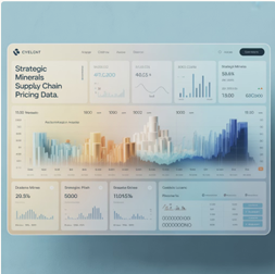
Global Mining & Mineral Landscape
Strategic Resource Intelligence
Mineral resources underpin modern civilization—from smartphones to electric vehicles to defense systems.
Understanding global mineral distribution is essential for economic planning, national security, and technological advancement.
Base Metals
Iron ore, copper, aluminum, zinc—foundational materials for construction and manufacturing
Battery Minerals
Lithium, cobalt, nickel—essential for the electric vehicle revolution and energy storage
Rare Earths
Critical elements for electronics, magnets, and advanced defense technologies
Precious Metals
Gold, silver, platinum—stores of value and industrial applications
Our platform visualizes global mineral belts, proven reserves, and geological hotspots
across all continents. Track key minerals and compare resource distribution across countries and continents
to understand geopolitical dependencies and supply chain vulnerabilities.
📊
AI Advantage:
AI maps mineral density patterns from satellite spectral analysis combined with geological datasets,
enabling faster exploration insights and identification of previously unknown deposits.
Strategic & Critical Minerals Dashboard
National Security & Economic Planning
Rare Earth Concentration
China controls 90% of global rare earth processing capacity
Cobalt Dependency
70% of cobalt comes from politically unstable regions
Demand Growth
Lithium demand projected to grow 300% by 2030
📊
AI Enhancement:
Predictive algorithms forecast future mineral scarcity scenarios,
import dependency risks, and global competition patterns
to inform strategic stockpiling, domestic production investments, and trade negotiations.
Extraction Benchmarking & Sustainability
Optimizing Operations While Protecting Environment
Modern mining must balance resource extraction with environmental stewardship and social responsibility.
Our platform enables transparent, data-driven mining operations that meet ESG standards while optimizing productivity.
1
Efficiency Benchmarking
Compare mining extraction efficiency, cost per ton,
emission intensity, and water usage across operations
globally to identify best practices.
2
Compliance Monitoring
Monitor rehabilitation compliance, land disturbance patterns,
and ESG performance metrics against regulatory requirements and international standards.
3
Threat Detection
AI detects illegal mining operations, land encroachment, environmental hazards,
and water contamination events through satellite analysis.
4
Optimization Planning
Identify opportunities for efficiency improvements, cost reduction, and environmental
impact minimization through data-driven insights.
| Metric |
Traditional |
With AI |
Improvement |
| Water Usage |
High waste |
Optimized |
40% reduction |
| Energy Cost |
Baseline |
Efficient |
25% savings |
| Compliance |
Reactive |
Proactive |
95% success |
| Safety Incidents |
Periodic |
Predicted |
60% decrease |
📈
Outcome with AI:
Smarter extraction planning, transparent mining operations that build social license,
optimized resource utilization reducing costs by 20-30%, and sustainable resource governance
that balances economic development with environmental protection.
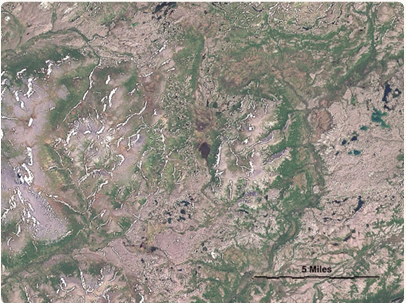
Satellite-Powered Mining Surveillance
What it Covers
- Detect & monitor active mining sites across the globe
- Pinpoint new mine expansions using satellite change-detection
- Map mineral-rich zones using spectral signatures from satellite data
▢
Why it Matters
Provides continuous & non-intrusive monitoring even in remote terrains
Vegetation & Environmental Loss Monitoring
🌳
Vegetation Degradation Tracking
Track forest removal & ecological impact over months and years
🗺️
Land Disturbance Visualization
Quantify soil stress, contamination risk, and surface disruption
🚨
Illegal Mining Detection
Generate real-time alerts for unauthorized activity & deforestation hotspots
AI Enhancement: AI models compare past vs present imagery to quantify green cover loss, soil stress & contamination risk
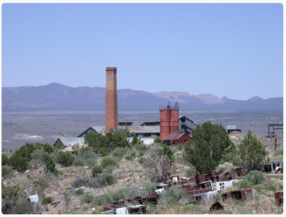
Smelting Zones & Industrial Activity Insights
Insights Provided
Thermal Signatures
Identify smelting plants & processing units using thermal + spectral analysis
Emission Patterns
Analyze heat emission, air quality & waste smoke distribution
Population Safety
Observe nearby settlements & identify risk zones for community protection
Outcome With AI: Real-time alerts, compliance reporting, safer mining decisions & sustainable mineral extraction with accountability